Monday, August 18, 2014

Calabash Creek, SC

Our destination for today is Calabash Creek, 30 miles southwest and just over the South Carolina border -- we have been in the Inner banks of North Carolina for 13 days and were ready to move on to another State -- it would feel like real progress.

The creek would also position us well for the next day's itinerary, transiting "Pine Island Cut", a 28 mile long stretch of the Intercoastal blasted through solid rock in the Myrtle Beach area. The guidebooks are all very clear -- unlike the rest of the Intercoastal, if you wander out of the channel in the cut, you aren't going to have a soft grounding in mud or sand; more likely, you'll rip a gash or even through your hull on the underwater stone ledges. To make things even more interesting, near the beginning of the cut is the "Rock Pile", an especially narrow 4 mile section, so narrow that the guide books all recommend you do a radio call before you enter it to make sure no commercial traffic is coming the other way -- so narrow you can't safely pass a bigger boat without risking ripping your hull on unseen underwater stone ledges -- OK, they had our full attention.

But that is tomorrow's challenge -- today is a much simpler journey down what's left of North Carolina. Largely wooded with some vacation homes lining it, the trip was pretty featureless -- not even a swing bridge to break up the monotony. The current did become foul for the last hour or, so the trip got prolonged some. And, the day was sweltering hot and muggy  -- you could feel that the sky was just itching to shed some of that moisture -- it seemed certain that thunderstorms would be in our future.
Oysters on pilings -- shellfishing areas, mostly "closed" to us, lined this section of the Intercoastal
Windswept trees, a common sight along this section of the Intercoastal
We arrived at the creek in early afternoon and scoped out the anchorage -- it was a small basin behind a mark just off the Intercoastal -- might have fit a couple of boats. It was empty when we got there, so we dropped our hook -- we were home for the evening -- time to take a swim and try and fix the knotmeter.

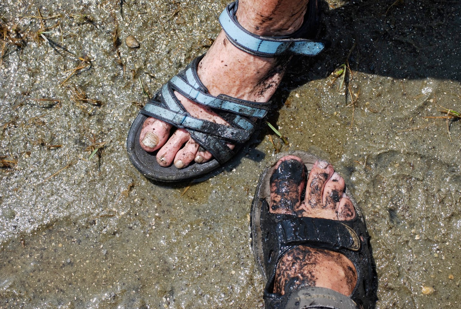
The current was still ripping through the anchorage, so after putting out a downstream safety float and Sue rigging a line on the side of the boat to hold onto while I worked, I got into the water -- it was a murky brown (more tannin), but with a some help from Susie adjusting the hull position of my "hold onto" line, I was able to get to the right spot and spin out the sand that was clogging the paddle wheel (I actually saw grains come out - H'ray, that should do it)!

The evening's entertainment was thunderstorms -- lots and lots of thunderstorms. We were totally surrounded by them. Sue and I sat on deck with a front row seat for over an hour watching the show all around us -- spectacular multi-armed lightening would jump from cloud to cloud; huge angry-looking bolts would strike downward from the clouds to the earth; thunder was constantly rumbling in the sky around us, sometimes quite loud and feeling very close. Yet with all this fury around us, we sat in an island of calm -- nary a bolt of lightening or a drop of rain came near us ! And the price of admission was "free" :-)

Sunday, August 17, 2014

St. James Plantation Marina, Southport NC

We had a quiet night and woke to a beautiful sunny day. Our next stop was going to be the St. James Plantation Marina, located in Southport NC, about 35 miles away, The route would take us through Snows Cut, a man-made channel to the Cape Fear river, down the river and back into the Intercoastal for about 5 miles.

While we had a good time in Wrightsville, we were happy to be leaving -- our dashed expectations for a peaceful anchorage coupled with the crowds just didn't make it our kind of place.
Paddle Boarders in the channel as we leave Wrightsville
The Wrightsville Bascule bridge, taken in early morning -- hence, no traffic
Our exit was easy as was the first part of the trip -- there would be no annoying bridges today and much of the trip would be in deep water in the Cape Fear river. We did have a foul current early on, but by the time we got to Snows Cut it was helping us, big time -- we went through the cut at almost 8 knots all the way      down its 2 mile length -- there were a few white knuckle moments trying to read the buoys as we wove  our way through the channel into the Cape Fear river, but we got things sorted out and were soon happily heading down the river in deep water.

The Cape Fear river got its name in the obvious way -- it meets the Atlantic at the infamous Frying Pan Shoals, a 30 mile stretch of shifting shallows off the coast that has swallowed many boats over the centuries -- indeed, the coast off Outer Banks has become known as the Graveyard of the Atlantic and Frying Pan Shoals is a large part of he reason why. We wouldn't be exiting the river into the shoals; rather, we would re-enter the Intercoastal waterway near the river's mouth, passing through Southport, a relatively large town at the mouth.

About halfway down the river, the current turned against us -- and not by just a little -- at one point we were barely making 1.5 knots forward motion -- fortunately we had gotten most of the way down the river part of our journey before this happened; unfortunately, we still has a few miles to go -- eventually (it felt like forever) we exited the river and rode the now fair (for us) current down the Intercoastal to our destination.

Birds along the way:


The St. James Plantation Marina is a brand new set of condos cum Marina right off the Intercoastal. We chose it because it had a laundry, something we both needed badly. It also had a nice bar, restaurant, wifi, etc. -- all the basics of life :-) The day had become very hot and muggy, in fact a "heat advisory" day, so we were happy to be able to use the A/C too cool down the boat -- life was good.

I wanted to try and clean my clogged knotmeter while we were in the Marina; this would require me to get in the water and dive under the boat to see if I could "spin out" the sand that had gotten in there. The water was dyed a rose red (we were back in tannin stained water country) which would limit my visibility, but I didn't have to go deep (the bottom of the hull is perhaps 12" under water where the paddle wheel protrudes through the hull).

Before I did this, I asked the Marina Manager whether it's be OK to get in the water; he said sure, they had divers going all the time to do work -- he also mentioned that an alligator used to hang around the Marina, but he hadn't seen him in a while and I should be OK. (Pulling my leg????)

OK, so armed with this "intelligence", I went down to our dock and looked carefully around to see whether there were any "critters"  hanging in the area -- no point in taking unnecessary risks! I got in the water but, after a few attempts, realized that I was not going to be able to get to the paddle wheel -- it was on the side of the boat against the dock, and there just wasn't enough room between the boat and the floating docks for me to comfortably work -- this task will wait for another day.

Saturday, August 16, 2014

Wrightsville Beach, NC

Our goal for today is to get to Wrightsville beach, perhaps another 25 miles down the Intercoastal -- it had been "touted" to us as a great place to stop by Stan, a "live-aboard" we met in Elizabeth City. He made it sound like a peaceful place to stop and recharge your "emotional" batteries -- we were really looking forward to it.

The tide cycle was such that we ended up leaving Topsail Sound at about the same tidal point as we arrived -- low tide, but at least it was rising. I had learned about some of the idiosyncrasies of the channel on the way in yesterday, so I was determined to try and pick my way out without running aground -- I bumped a couple of times, and had almost made it out when I ran the keel softly up on a bar -- easy enough to get off, but it spoiled my "perfect exit" attempt :-(

It also took out our knotmeter -- it stopped working. I was pretty confident that the problem was sand kicked up into the paddle wheel during my "ungrounding" attempt -- I would have to go over the side at some point down the road to try and fix it.

The route transited two new bridges; like yesterday, one only opened "on the half hour" and the other "on the hour". We managed to have to wait almost the full period for both --so it goes.

The second bridge connected to the mainland to Wrightsville Beach, our destination for the evening -- we had to go through it to enter the side channel to get to our anchorage. From about a mile away, we could see there were lots of buildings and boats on our side of the bridge -- as we got closer, it became evident that this was a "happening" place -- both sides of the Intercoastal were lined with huge Power Boat marinas and there were boats moving every which way -- think the Times Square pedestrian mall on a busy afternoon -- people crossing every which way, heads down and focused on getting to their destinations -- that's what it was like, only the people were boats..
One of about a dozen similar marinas right on the Intertcoastal in Wrightsville
The tedious task of waiting for this bridge fell to Sue (we rotate the helm every couple of hours) -- not only did she have to be mindful of the strong current running through the area, she had to avoid boats moving everywhere as she circled to kill time -- a tough job. When the bridge eventually opened,  there was a "rush" for boats to go through the opening from both sides. Sue did a masterful job weaving her way through this mess and turned down the channel for our anchorage -- which, by the way, was also lined on one side with Marina, restaurants and condos.

At this point, it was clear that Wrightsville Beach wasn't going to be the "peaceful" anchorage we both had imagined -- something "got lost in the translation" from Stan's description. Indeed, the anchorage turned out to be lined with Condos and Town Homes on both sides and ended at a low causeway connecting the mainland to the Wrightsville Beach Barrier Island.

The good news is that the anchorage was roomy (there were about 8-10 boats in it), the holding was good and the town provided a nice dinghy dock nearby nearby So, instead of swimming and hanging out in a peaceful anchorage, we opted to get some grocery shopping done, take a walk and have dinner ashore.
Wrightsville beach as seen from our cockpit
Heading out for our walk
At the Restaurant
Talking to Kerry while sipping a sundowner

Friday, August 15, 2014

Topsail Sound, NC

Today's goal is to do about 35 miles to get to Topsail Sound, a wide, open salt marsh area with some deep water behind a barrier island lined with vacation homes. According to our guide, there is a well marked, but shallow in spots, channel in -- and not recommended for boats drawing more than 5 feet -- making it (barely) doable for us.

The Intercoastal has a 10 miles stretch cutting right through Camp Lejeune, a huge (256 square miles!) training base for the Marines -- typically 50,000 marines are stationed there. Not only does the Intercoastal cut through the base, it cuts through one of its firing ranges -- thankfully, the Marines close the waterway whenever they are firing across it. There is even a phone number you can call to find out whether they will be firing today -- we checked it and hurrah, no target practice today.
On the way to camp Lejeune -- there is no shortage of big, lovely homes along the Intercoastal
Loved gnarly tree

Well, almost -- while the Marines wouldn't be closing the Intercoastal for target practice, there are lots of other firing ranges on the base (54 according to one source), some of which are pretty close to the waterway. We could hear and feel the concussions from explosions from a few miles out; as we got closer to the base, they got louder (and closer!). One, in particular, landed behind a hill perhaps a quarter of a mile from our position -- the noise was "thunderclap" sharp and loud, the concussion tangible and we could see the smoke rising over the hilltop -- sure made me wonder whether they've ever had any mishaps that involved passing boats :-)
Marines patrolling the Intercoastal in Lejeune
Birds ignoring the Danger signs in Lejeune
Ya gotta love it -- water skiing down the Intercoastal in Lejeune

In addition to dealing with firing ranges, today's itinerary requires us to transit two swing bridges -- remnants of a bridge building boom in the early 20th century, these bridges are old, slow and because they typically connect densely populated barrier islands with the mainland, they open infrequently -- in one case today, just once and hour. Because the Intercoastal has lots of unpredictable currents, it's hard to "time" yourself to arrive at exactly the right time -- so basically, it's "bridge roulette" as to whether you get to wait or not. As it turned out, we only had to wait a few minutes for the first bridge, but the second, cost us almost a full hour of "waiting", particularly frustrating because it was close to the end of our trip.
A typical swing bridge -- it rotates out of the way so you can drive through
On the bright side, we did see dolphins gracefully feeding themselves a few times along the way  -- we were now well below Cape Hatteras, which is kind of a "Mason Dixon" line for fish -- north of the cape is predominantly Northern fish species, the porpoise being among them; south of the cape is predominantly Southern fish species -- so we were seeing dolphins (porpoises have triangular fins, dolphins curved, like "Flipper").
Dolphins feeding
This blue heron followed us for a while
The trip down was otherwise uneventful until we got to the 1.5 mile long channel to get into Topsail Sound -- as promised, it was well marked but shallow in spots -- there were two spots where we bumped on the way in and one other where I should "zigged" but instead "zagged" and we briefly ran aground. We were coming in just before dead low, so while a bit harrowing, the challenge wasn't a surprise.

Having said that, the anchorage itself was worth it -- on one side of the boat was nothing but an endless expanse of salt marsh full of bird-life, on the other, nice homes on a barrier Island. The water was clear (no tannin here), so we got in for a swim soon after setting our hook -- a little piece of heaven.
Parks his shrimp boat behind his barrier island home


Thursday, August 14, 2014

Swansboro NC

We awoke to another sunny, dry day with a cool breeze -- the weather has been very cooperative for our trip thus far -- we had been told this could be a "hot, muggy and miserable" trip, but thus far, with a couple of exceptions, we have had very pleasant weather. Hopefully our luck continues to hold out.

Today's run will be for 28 or so miles to Swansboro, NC -- we are working our way down the so-called "Crystal Coast" -- the stretch of NC from Cape Lookout (NE of Beaufort to the Cape Fear River -- the name comes from its "Crystal Clear" waters).

Our desire was to get off early, but as usual, current was ripping through the Marina and backing out of the slip was going to be difficult as best -- discretion being the better part of valour, we chose to wait for a couple of hours until the current weakened some. Even with the wait, backing out was a challenge -- we did a little scraping of a rub rail on a piling, but otherwise "escaped" from the Marina with no new dings.

The Beaufort-Morehead City harbor complex is very complicated and confusing, with many creeks and side channels coming together at the Ocean Inlet and with strong currents everywhere. We had to head down to the Inlet on our way out and then head up and away from it to continue down the Intercoastal. It was an intense 45 minutes or so of sorting out buoys and steering hard through current to keep My Weigh on track.

Passing by Beaufort inlet -- the Atlantic in the distance
Not a great shot, but I liked shadows on the dunes
Once we were out of the chaos of the sister cities, we settled into a long, uneventful run down the Intercoastal. We had current with us for much of the morning, but ended up fighting it for the last couple of hours -- this is typical for this section of Intercoastal -- the currents switch direction at every inlet -- as you approach an inlet that is draining, you get help, once you cross by it, the current switches and you are fighting it -- not much you can do about it.

There were two recommended anchorages near Swansboro, one just before we got to the town and one in its main harbor. Since we weren't planning on getting off the boat, we thought we'd use the more secluded one; after seeing it, however, we opted for going into the main harbor -- there wasn't enough swinging room to make me feel comfortable -- it must have shoaled up since the guide was written.

The anchorage in town was spacious and we were the only boat there when we arrived so dropping the hook was easy. I was hot and feeling grungy so I really wanted to take a swim -- there was quite a bit of current (I'd guess at least 3 knots), so I rigged a life preserver on a line to hang on to the boat -- the water was the color of rose wine (more tannin, I suppose) and I was literally "body surfing" on the current -- kinda fun and very refreshing :-) Sue took a rain check on this swimming session.
Downtown Swansboro -- we didn't go ashore 
Body Surfing in the current
Swansboro sunset
Love those pastels

Wednesday, August 13, 2014

Beaufort, NC

Overnight a cold front came through so we awoke to a bright, sunny and coolish day  - nice!

Today we were going to explore the town and the Carrot Island reserve. Before we did, however, I needed an hour or so to do something for my client, so Sue offered to use the courtesy car provided by the Marina to make a grocery run. We had discovered that the bilge's float switch had died, so she was also going to stop at a local marine shop to pick one up. Sue returned with the food but no switch -- the store was out of them -- this meant a longer ride over the bridge to another marine supplier in Morehead City, Beaufort's sister city.

I was done working, so I took the ride with Sue. The courtesy car was a 90's era Buick Road Master station wagon -- indeed, the Marina had a fleet of 3 of these behemoths (apparently the Marina's manager is "fond" of these vehicles -- indeed, we were told that he liked them so much, he bought one of the cars intended for the fleet for himself -- go figure). It had a noisy, barely working air conditioner, but otherwise worked -- it got us there an back -- it's really helpful when Marina's have loaner cars.

After lunch (and installing the new switch), we took a water ferry over to Carrot Island. One of two Islands between Beaufort and the Atlantic, it has been set aside as a nature reserve named after Rachel Carlson (wrote Silent Spring) who did field research there. We spent the next few hours walking through salt marshes and swimming off the Island's beaches -- we saw the feral horses as well as zillions of fiddler crabs, periwinkles, mud snails, ibis, blue heron, gulls and the like -- a nice way to spend a beautiful day.
The reserve has two nature trails -- we took the one through the marshes.

There were zillions of fiddler crabs everywhere -- the would evacuate the trail as we approached

The periwinkle snails were all over the marsh grass
A feral horse, evidently a male, staring intently at ......
A comely feral female
Whaddya expect, we were walking though a marsh !!

The ibis wouldn't let us get very close
The requisite random flower picture
Of course, we weren't the only people on the Island -- the ferry runs about once an hour and took perhaps 10-15 people at a time -- you spread out, but there are always other people in sight. While swimming, we ran into a local mom who had brought her two small children over for the afternoon. Sue got to talking to her and asked her for some recommendations for dinner -- we were planning to eat out -- she gave us two places, on a side street and next to one another -- and indicated that they were both great.
On the beach for a swim
Later that evening, we took a walk up to the restaurants, planning on checking out the menus and picking one for dinner. Not so fast -- the first, called the Grocery Store, was by reservation only -- they "might" have a table for us in an "hour or so". It looked very nice, but we weren't in the mood to wait for an hour; fortunately, the second, the Blue Moon Cafe, was able to accommodate us at a bar table (they also were reservation only). Who knew that you couldn't get a seat at a decent restaurant in Beaufort on a Wednesday night? (By the way, as is our habit, we had drinks and appetizers -- the food was great -- we had a Shrimp and Mango over grits appetizer that was both unique and delicious.)

Tuesday, August 12, 2014

Beaufort, NC

We woke to a calm morning -- yesterday's howling winds were gone.

Our goal for the day would be to get to Beaufort, our first stop close to the Ocean since Cape May -- we were both looking forward to smelling the salt in the air and being able to take a swim in clear (as opposed to tannin-colored) water. We are going to skip Oriental NC, a town that has become know as the "Sailing Capital of North Carolina" -- we had been there many years ago (by car) -- nice enough place but the siren call of the Ocean was much stronger.

Beaufort advertises itself as the "3rd oldest city in North Carolina" -- first settled in the early 1700's, the city became infamous as a haven for pirates. Piracy was common occupation in the area in the 17th and 18th centuries; some would walk a horse with a lantern around its neck along the beaches of the Outer Banks to intentionally lure ships to their "doom".  Edmund Teach, a.k.a., Blackbeard, was known to hang out in Beaufort and what are believed to be the remains of his ship, the Queen Ann's Revenge, were recently discovered in Beaufort Inlet.

Today' Beaufort is quite gentrified, consisting of mostly tchotchke shops, boutiques, restaurants and the like. Most of the downtown area hasn't changed much since the 1700's -- the old buildings still abound. The old part of town lies along Taylor Creek, a straight as an arrow estuary of the inlet, the other side of which is Carrot Island, a sanctuary for feral horses -- all in all, a fun place for us to stop.

The trip from Broad Creek to Beaufort was relatively simple: up the Neuse River, into Adams Creek which eventually (through a canal cut or two) gets you to the top of the waterway connected to Beaufort inlet -a 30 mile or so run.
The Neuse River was like glass -- hardly a wind driven ripple on it
This little "cottage" was at the entrance to Adam's creek
No, this isn't "Jaws"-- it's a porpoise feeding in Adams Creek
More feeding porpoise -- we saw many pods on this creek
Anyone interested in a chateau on Adams creek?
Suddenly all of the Osprey nests were empty -- the chicks were out on their own
Our original plan was to drop and anchor in Taylor's creek, right at the Beaufort waterfront. Unfortunately, there wasn't much room for us -- the creek is long and narrow and has a strong reversing current due to the proximity of the inlet -- we really couldn't find a spot with enough swing room for My Weigh (note to self: get second anchor for boat so you can control swing in situations like this). We ended up taking a slip at the Beaufort Town Dock Marina.

The landing in the slip wasn't pretty but got the job done -- we got pinned to the floating dock before we got all the way into the slip by the strong current ripping through the creek. With some  pushing and tugging by the Marina staff, assisted by My Weigh's engine, we managed to get her in and settled for the evening.

Downtown Beaufort, from our cockpit; A (good) band played till 10 each evening at the bar in the building to the left